GeoAI Services
by BHUMI
AI-powered geospatial analytics for near-real-time environmental monitoring and resource management
Supporting government and private organizations with cutting-edge Earth observation solutions
Our Capabilities
Leveraging state-of-the-art technology for comprehensive geospatial solutions
Satellite Monitoring
Multi-spectral imagery from Sentinel-2, Landsat & commercial satellites
AI Analytics
Deep learning models for automated feature extraction & classification
Predictive Modeling
Time-series analysis and change prediction for proactive management
Real-time Processing
Cloud-native infrastructure for rapid data processing and delivery
Global Coverage
Our GeoAI solutions operate across diverse ecosystems and regions worldwide
Our Services
Comprehensive geospatial solutions powered by AI and satellite technology
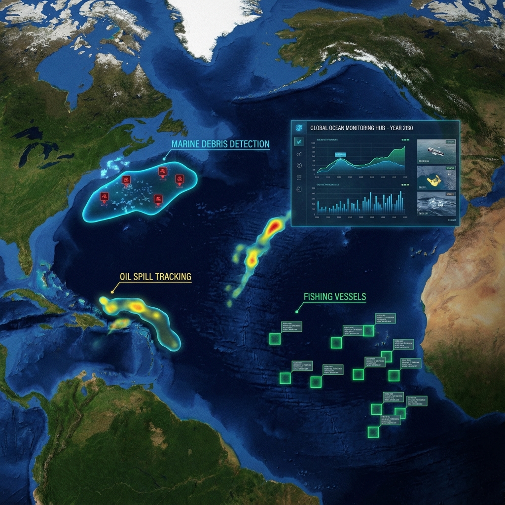
Marine & Coastal Monitoring
Sea Surface Temperature, Salinity, Chlorophyll, Harmful Algal Bloom Detection, Marine Debris & Oil Spill Detection.
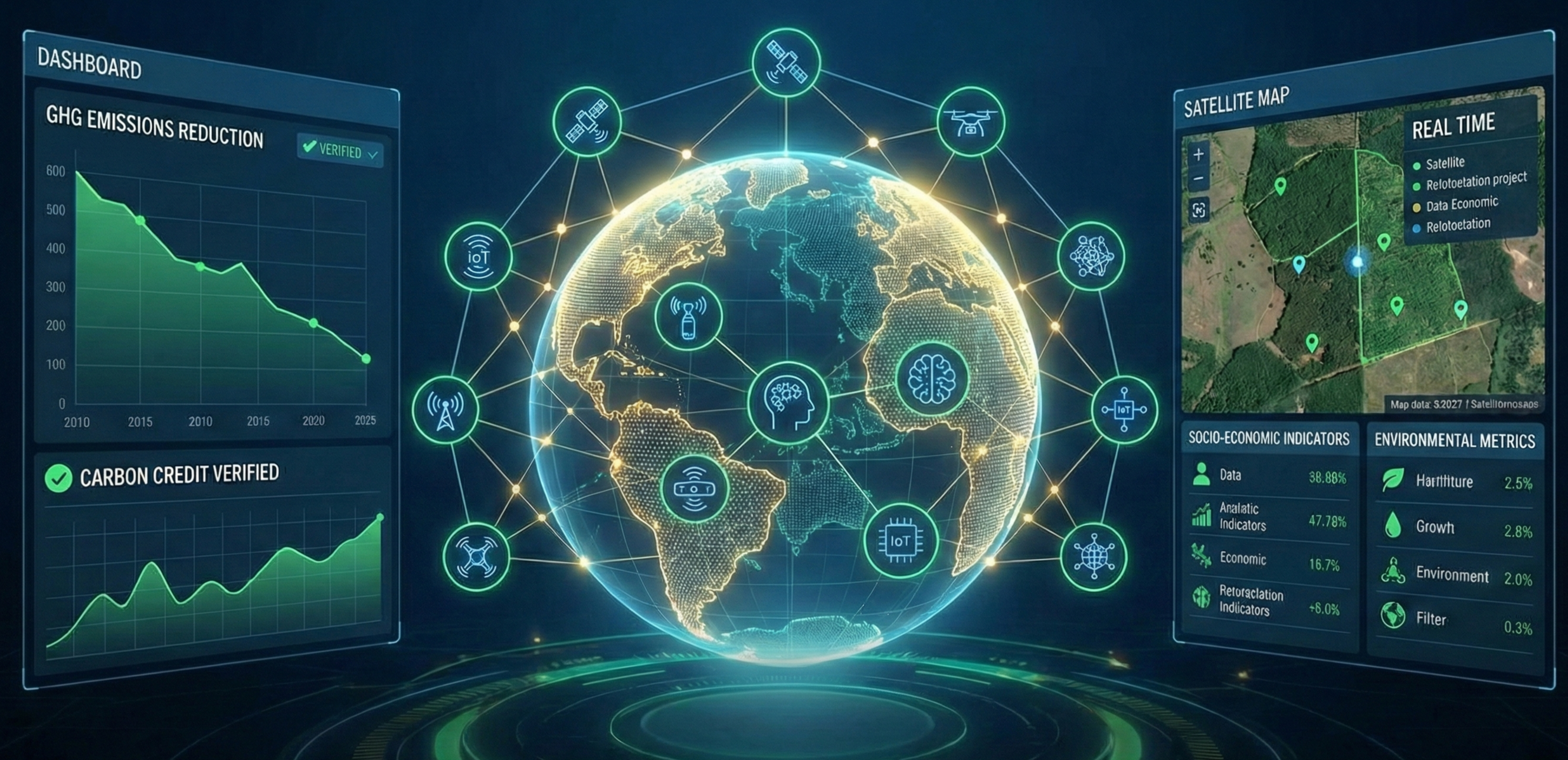
Project Monitoring & Evaluation
Impact assessment (socio-economic, environmental), GHG emissions calculation, Carbon credit estimation, and sustainable agriculture.
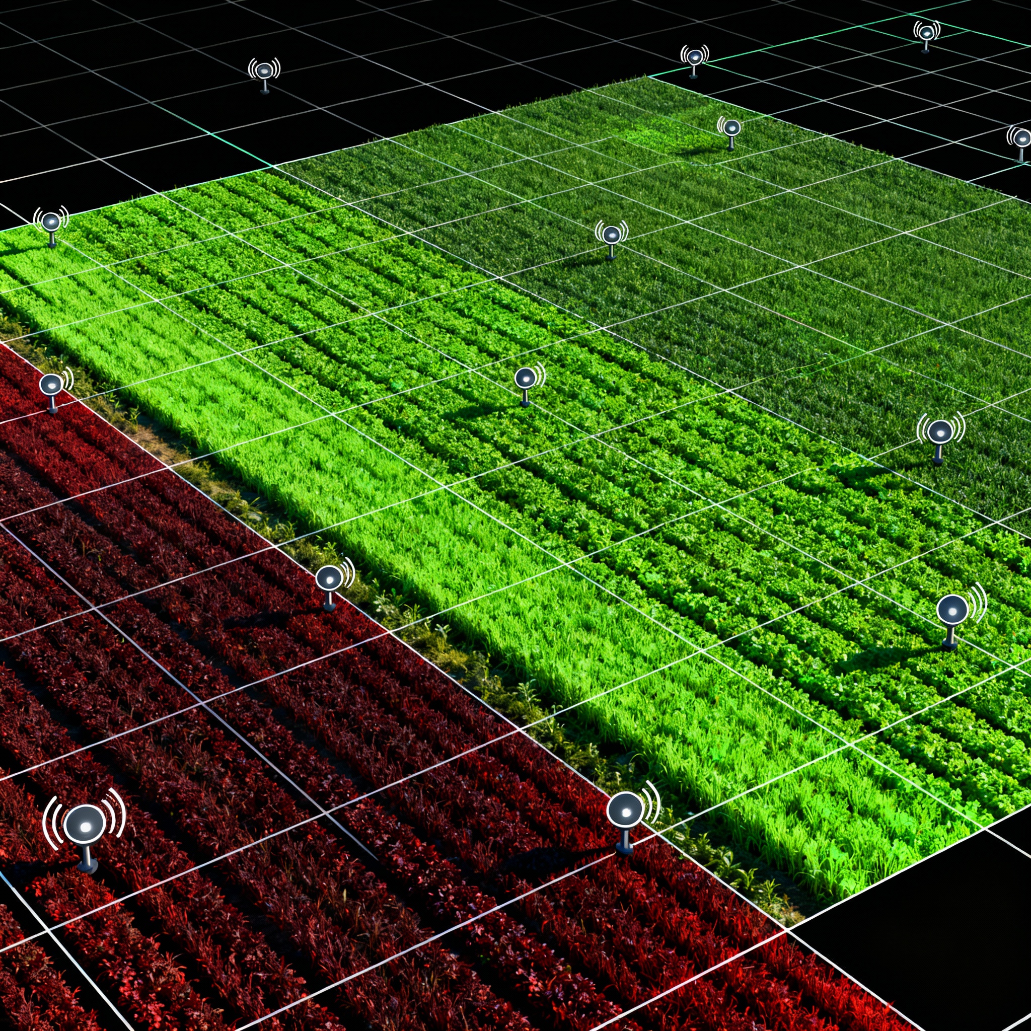
Agricultural Practices
Crop type mapping, yield estimation, damage monitoring, sustainable practices, and climate-resilient precision farming.
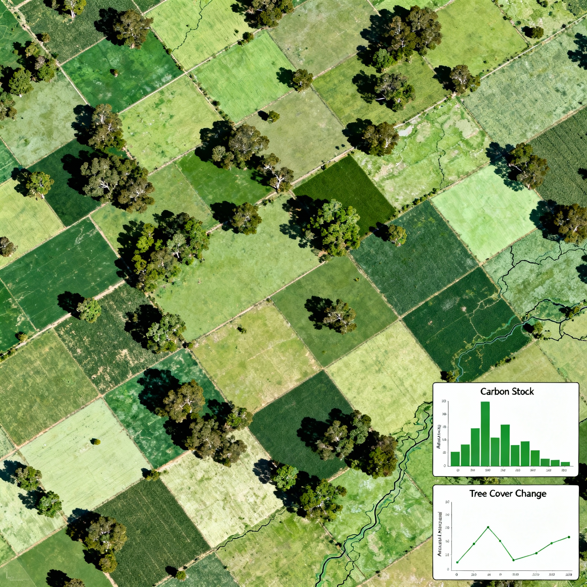
Agroforestry
Species mapping, site suitability analysis, intervention monitoring, carbon stock measurement and tree cover change.
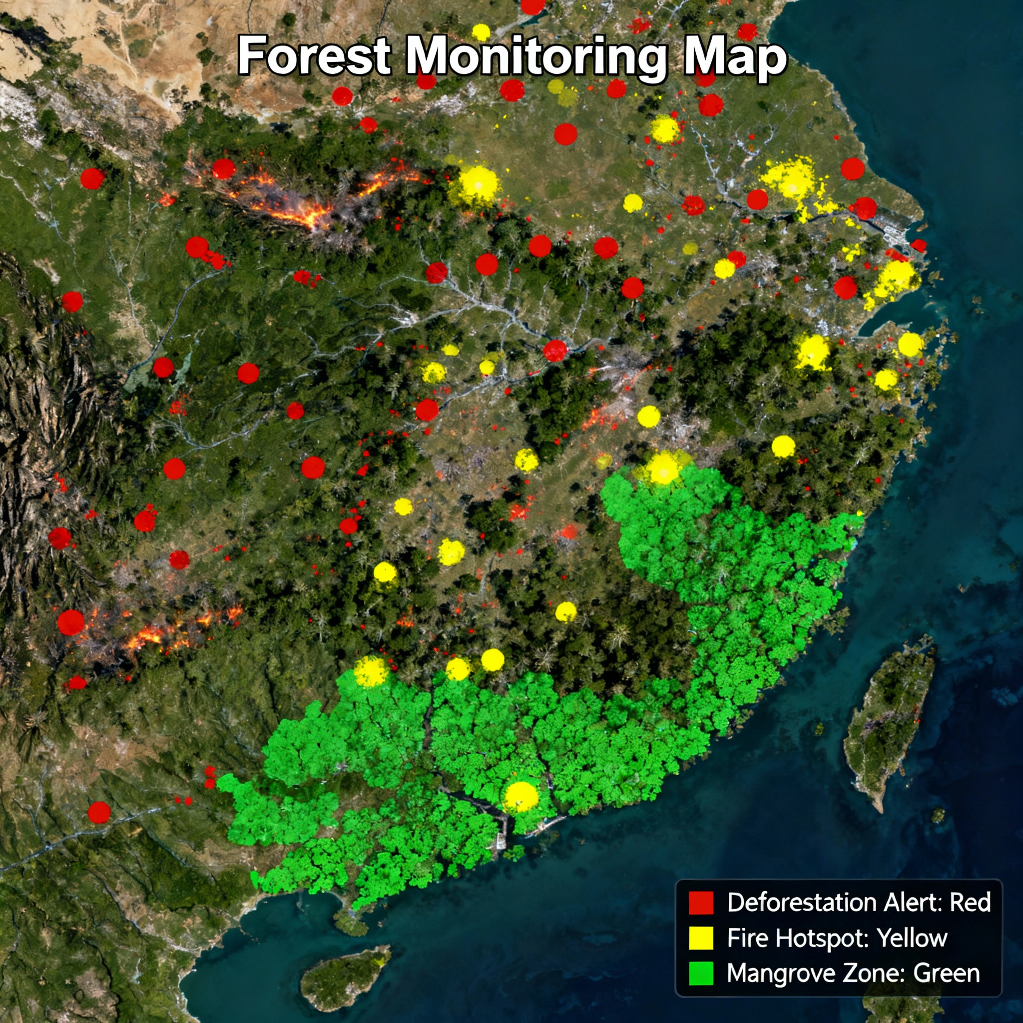
Forest Resources Monitoring
Deforestation/afforestation detection, invasive species, mangroves, ecosystem services, carbon stock, and fire mapping.
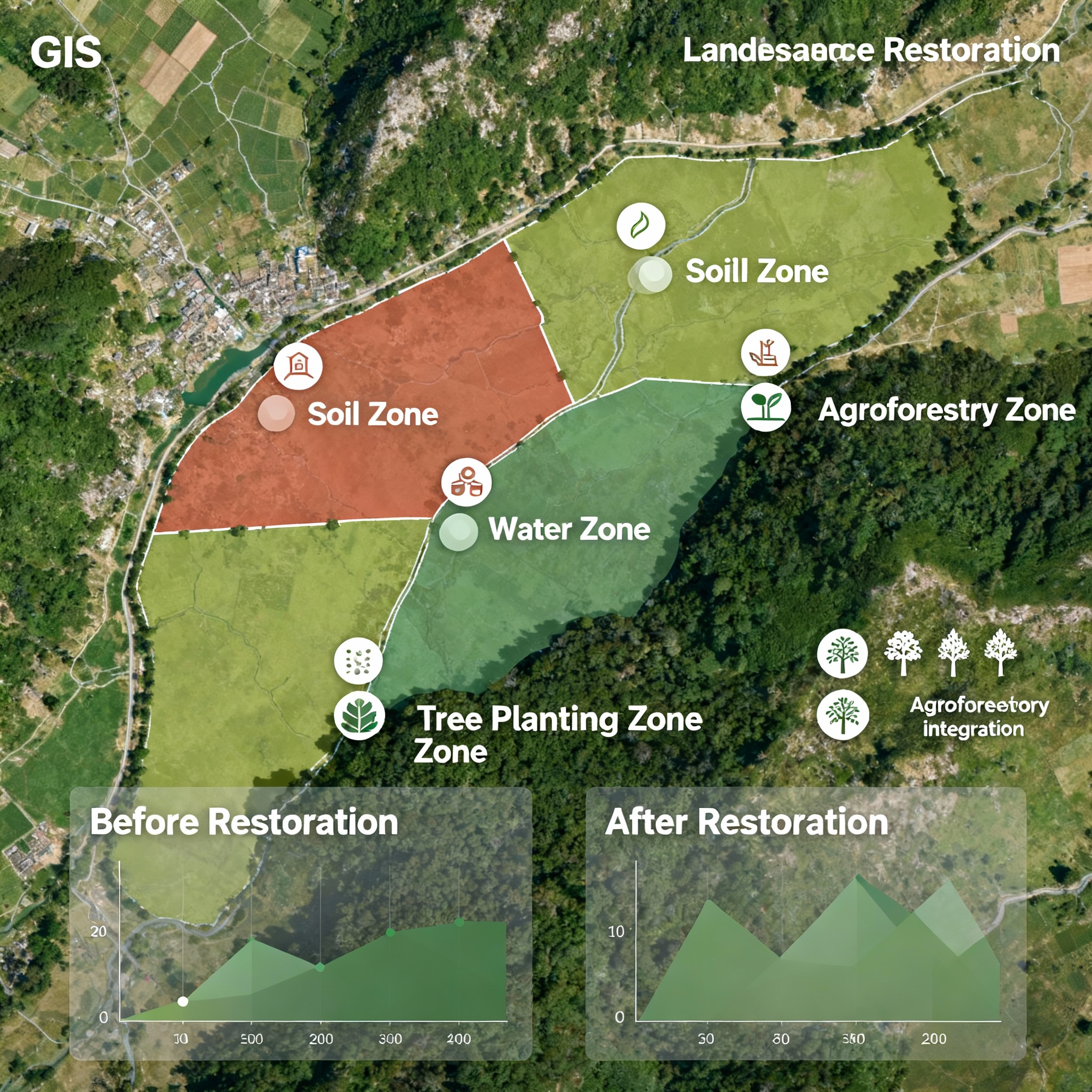
Landscape Planning & Restoration
Land use analysis, restoration planning (soil, water, agriculture), implementation monitoring and impact analysis.
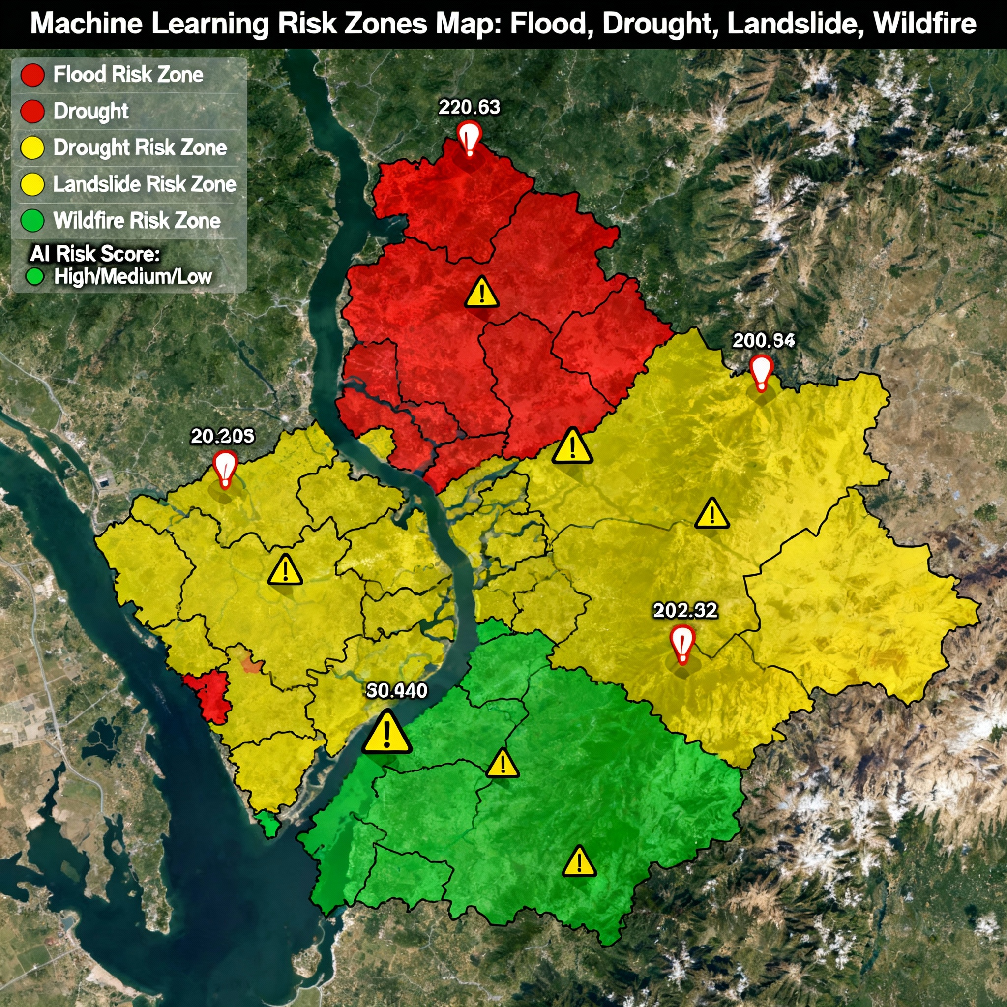
ML for Natural Hazard Mapping
Flood, drought, landslide, wildfire mapping for risk assessment, early warning systems, and disaster management.
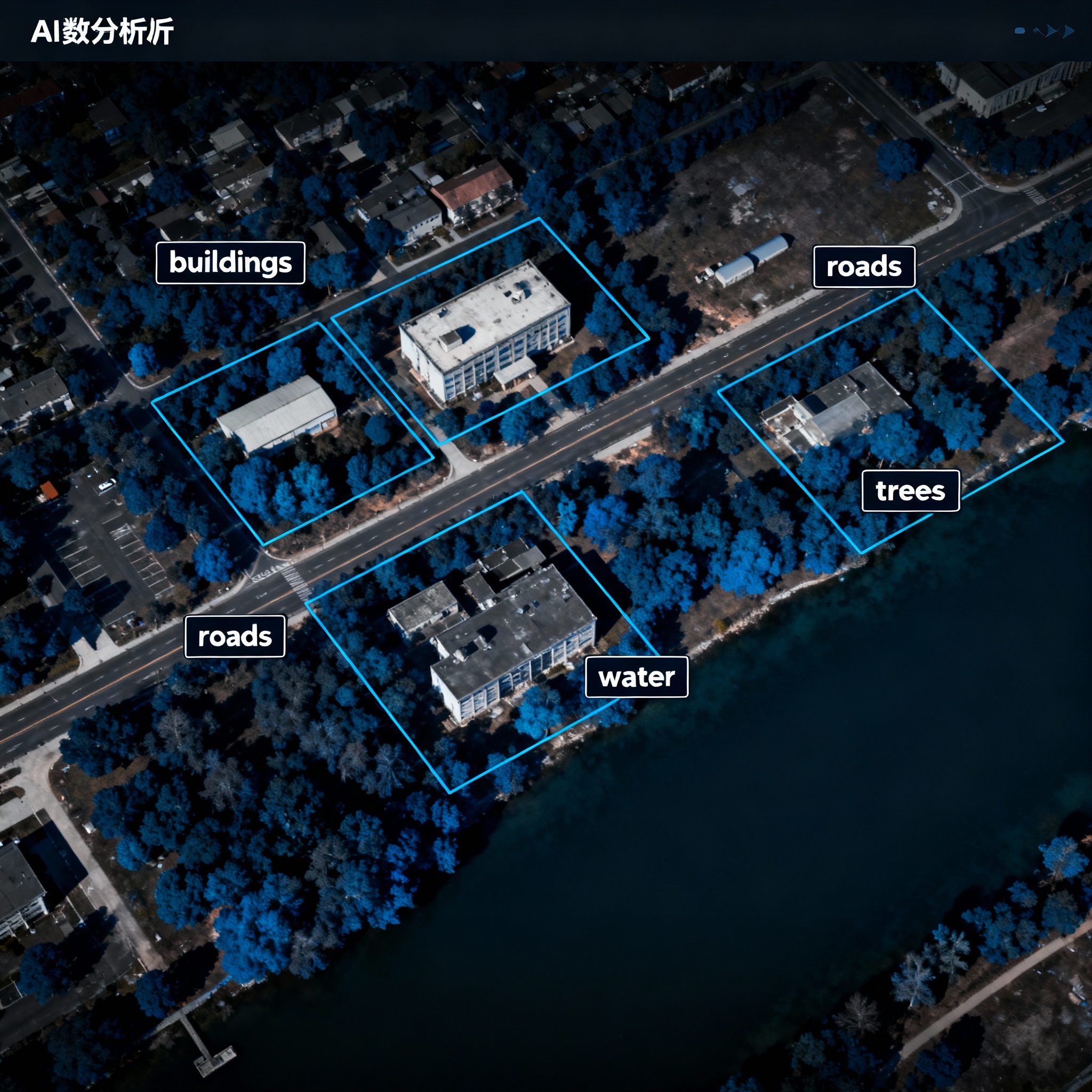
Deep Learning Object Detection
Object detection for resources monitoring, decision-making, planning, and policy development.
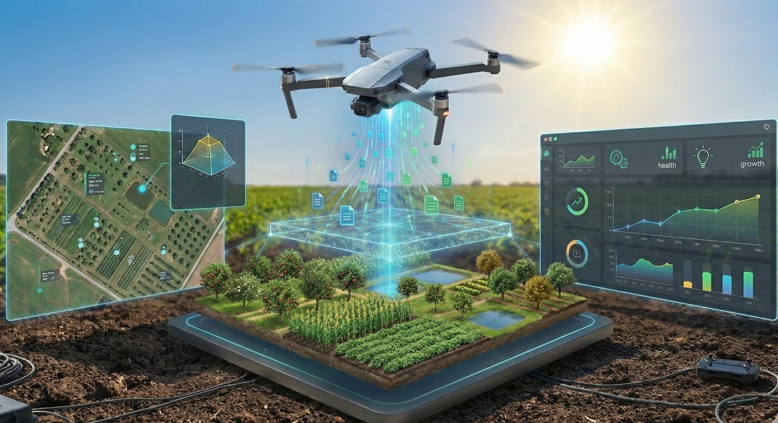
Drone Data Processing
UAV photogrammetry, orthomosaic generation, 3D mapping, volumetric analysis, and real-time aerial monitoring.
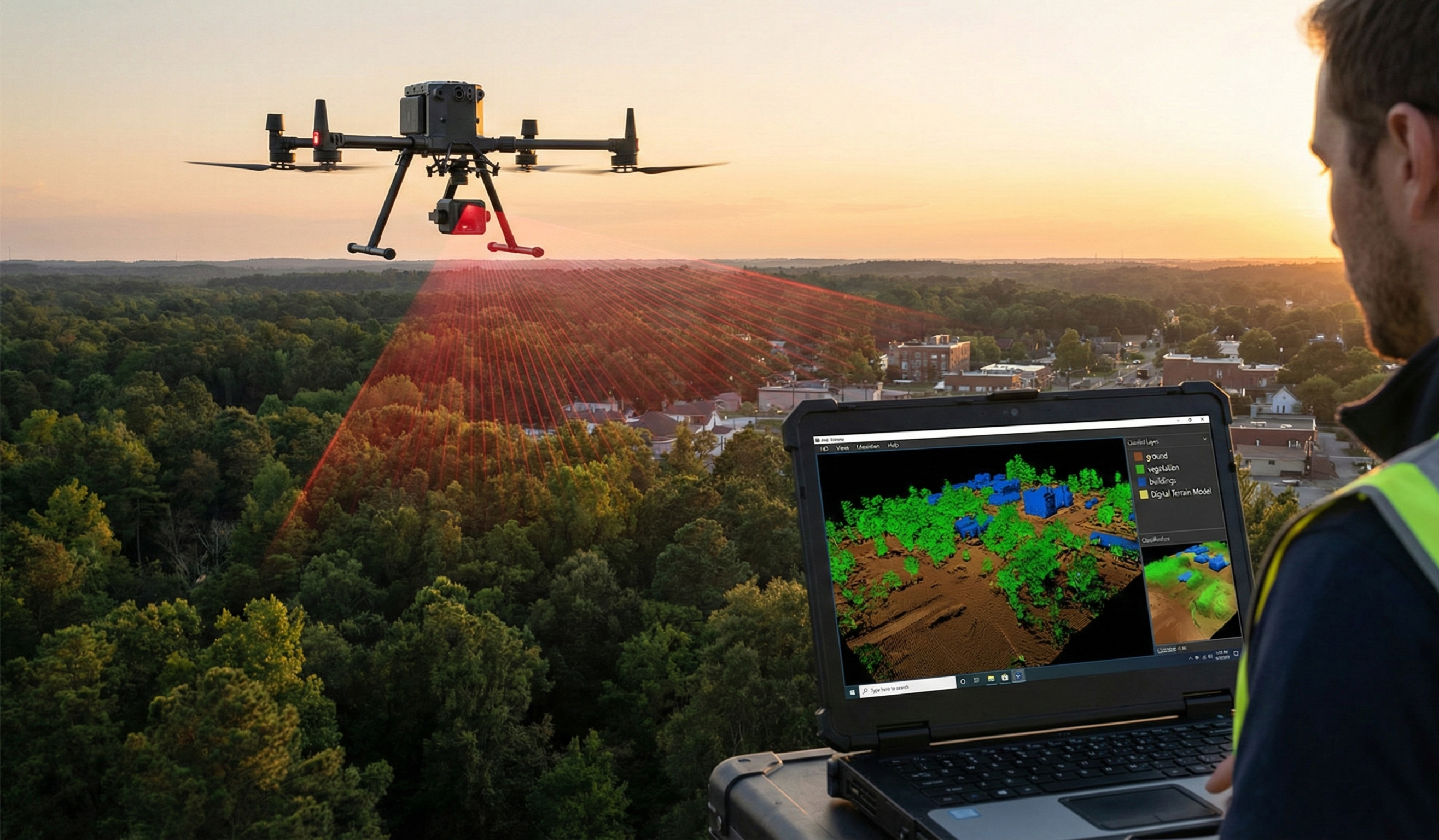
LiDAR Point Cloud Processing
Point cloud classification, DTM/DSM generation, canopy height models, feature extraction, and terrain analysis.
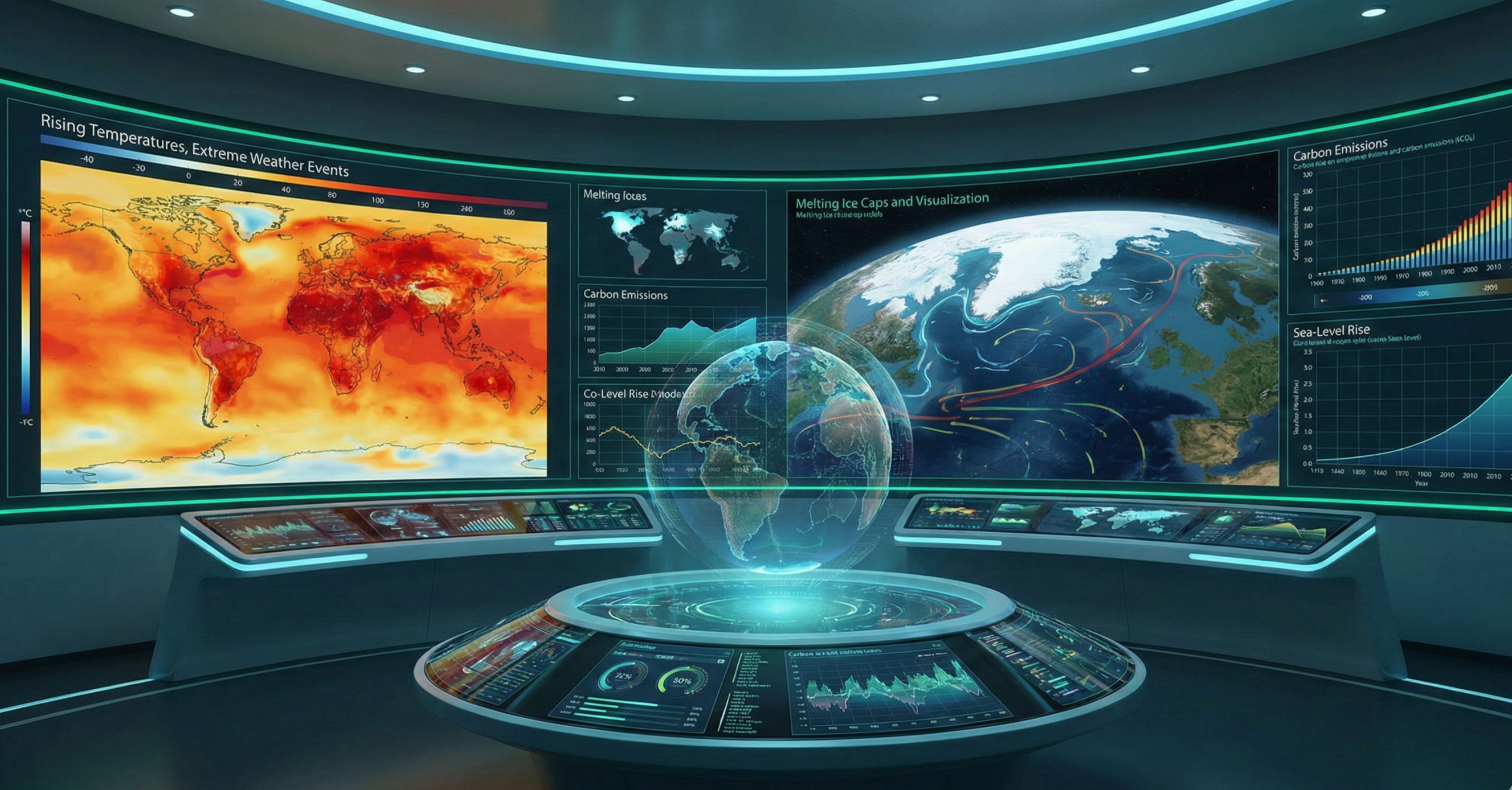
Climate Change Analytics
Carbon footprint modeling, climate risk assessment, emissions tracking, and sustainability reporting.
Industries We Serve
Tailored solutions for diverse sectors
Ready to leverage
GeoAI for your projects?
Partner with us to unlock the power of satellite technology and AI for environmental monitoring